The Ontario Building Code (OBC) and the National Building Code of Canada (NBCC) set clear expectations for geotechnical investigations on sloping terrain, yet the real challenge in Kitchener is how the local glacial geology interacts with those requirements. The city sits on a complex arrangement of Port Stanley Till, recessional moraines, and glaciofluvial deposits left by the Wisconsinan ice sheet. When a slope fails in the Grand River valley or along a creek ravine near the Waterloo Moraine, the failure mechanism rarely matches textbook assumptions. Our team has learned to read the subtle signs: sand stringers within the till that act as perched aquifers, softened clay zones where groundwater seeps for months, and surface cracks that open after heavy spring melt. A thorough slope stability assessment in this region demands more than limit equilibrium software. It requires on-site judgment informed by dozens of projects completed between the Grand River and the Speed River watersheds.
A Kitchener slope rarely fails because the till is weak; it fails because groundwater found a path nobody anticipated.
Methodology and scope
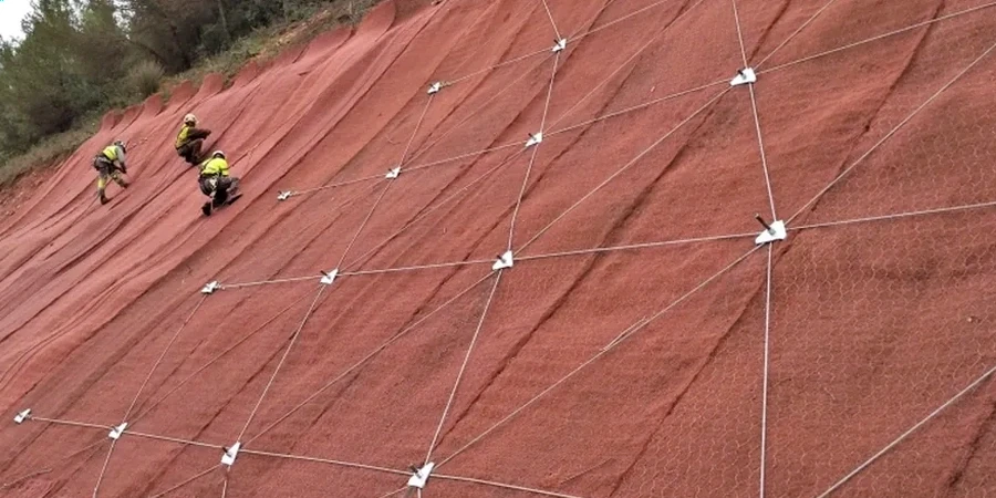
Site-specific factors
A tracked CPT rig moving along the edge of a ravine tells you more than the cone resistance data alone. The vibration from the tracks, the way the ground deflects under the outriggers, the sudden change in penetration rate when the tip crosses from desiccated crust into soft silt — these physical cues feed into the slope stability model back in the office. Kitchener's stiff till can feel deceptively competent during a dry August site visit, but the same material becomes dangerously slick when saturated in April. We have seen slopes stand at 70 degrees for years, then move half a meter during a single rain-on-snow event. The risk is rarely obvious from the surface. That is why our field program includes pore pressure measurement using vibrating wire piezometers installed during the drilling phase, and why the laboratory program includes drained and undrained triaxial testing on undisturbed Shelby tube samples from the critical failure plane depth.
Reference standards
NBCC 2020 (National Building Code of Canada, Part 4), Ontario Building Code (OBC) Division B, Part 4, ASTM D4767 (Consolidated Undrained Triaxial Compression Test), CSA A23.3 (Design of Concrete Structures, relevant for retaining elements), MTO Manual of Geotechnical Engineering (referenced for stability grading)
Associated technical services
Site Reconnaissance and Geomorphic Mapping
Detailed walkover survey mapping tension cracks, seepage zones, slope inclination changes, and drainage patterns across the Grand River valley and tributary ravines, correlated with published Quaternary geology maps for the Waterloo region.
Subsurface Investigation and Instrumentation
Drilling, sampling, and installing standpipe and vibrating wire piezometers to define the groundwater regime within the till and underlying aquifers before performing limit equilibrium and finite element analyses.
Stability Analysis and Remedial Design
Two-dimensional and three-dimensional stability modeling (LEM and FEM) to recommend slope regrading, drainage improvements, soil nailing, or retaining structures that meet the minimum factor of safety required by the local conservation authority.
Typical parameters
Frequently asked questions
What is the typical cost range for a slope stability analysis on a residential lot in Kitchener?
For a single-family lot with a steep backyard ravine, the analysis including a limited drilling program, instrumentation, and a signed report typically falls between CA$1,520 and CA$5,270, depending on slope height, access constraints, and whether groundwater monitoring is required over one or more seasons.
How do the Grand River Conservation Authority regulations affect a stability analysis?
The GRCA reviews geotechnical reports for properties within regulated floodplains and valleylands. They require the analysis to demonstrate that proposed works will not destabilize the valley slope or increase erosion, and they often specify a minimum static factor of safety of 1.5 for long-term conditions.
How long does a complete slope stability study take?
Fieldwork including drilling and piezometer installation usually takes three to five days. If the project requires seasonal groundwater monitoring, the data collection phase extends over four to six months. The analysis and reporting phase typically takes two to three weeks once all lab data and monitoring readings are available.
Can old landslide scars in the Grand River valley be safely built near?
Building near a relict landslide requires extra caution in Kitchener because the pre-sheared failure surface likely has residual strength much lower than the intact till. A site-specific investigation with ring shear testing and careful mapping of the slip surface is essential before any setback or foundation recommendation can be made.